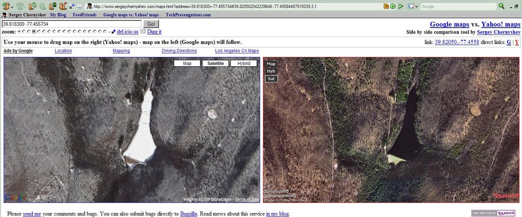
The image above is a screen capture from an amazing map hack by Sergey Chernyshev that puts Google (left) and Yahoo! maps side by side. To get the above comparison of the Waynesboro Reservoir in the Waynesboro Watershed (where we hold many labs in the Penn State Mont Alto forest technology program) first go to this web address: http://www.sergeychernyshev.com/maps.html . Then enter these search coordinates: 39.818300 -77.455734 (latitude and longitude). Make sure to choose satellite imagery to see just the images or hybrid to see the images and roads.
Both images are high resolution, high quality. Online mapping services tend to have spotty coverage of the best imagery around the US. Google shows a winter scene, where the reservoir is frozen. Yahoo! shows a slightly color enhanced summer scene. The road networks use the same data from Navteq. It' great to be able to see them together side by side.
Online mapping is a trend. It's likely that foresters and other natural resource managers will be using these tools in the future to improve their understanding of the forests and to make field work more efficient. Thanks, Sergey, for this new tool.
1 comment:
You can use direct link too: http://www.sergeychernyshev.com/maps.html#39.8183,-77.455734,3,1
URL of the page is updated when you move your map or change zoom level/map type so it always referencing current image.
Sergey Chernyshev
Post a Comment